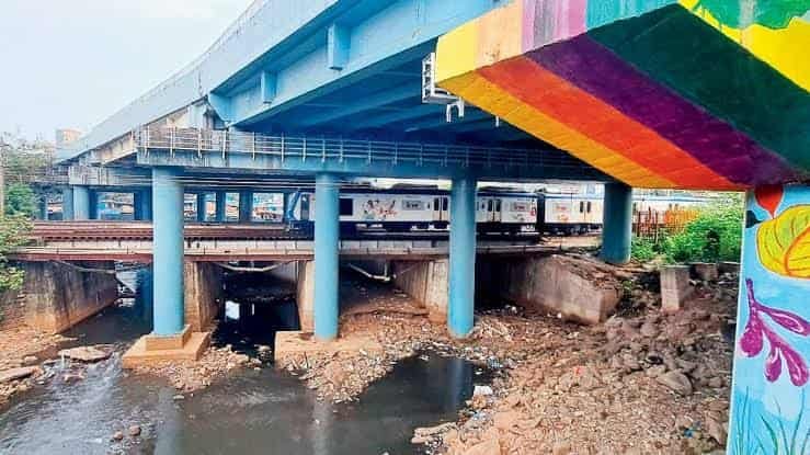
“Speeding careful as it has a sharp turn in mid way. Accident prone.” That’s an actual commuter review left on this flyover, and it tells you everything about why knowing the layout here matters more than usual. Named after Sudhir Phadke, the legendary Marathi music composer, this structure in Borivali West does the essential job of linking the Western Express Highway to SV Road — but the mid-span curve has caught out more than a few drivers over the years. If you’re navigating between Borivali and Dahisar regularly, or passing through for the first time, here’s what to know before you’re on it.
Quick Overview
| Aspect | Details |
| Location | Borivali West / Dahisar West, Mumbai |
| Named after | Sudhir Phadke, Marathi music composer |
| Main road connections | Western Express Highway, SV Road |
| Nearest railway | Borivali Station (Western Line), 4-minute walk |
| Nearby landmarks | Swami Narayan Mandir, Kandarpada, Daulat Nagar |
| Public transport options | BEST buses, Western Railway suburban trains, Borivali-Gorai ferry |
Why Locals Flag This Flyover for Its Turn, Not Its Traffic
Sudhir Phadke Flyover sits at a genuinely useful junction, connecting highway traffic on the Western Express Highway directly to SV Road — a link that saves considerable time for anyone moving between these two major North Mumbai corridors. But the structure has a sharp mid-span curve that’s become something of a local reputation, with commuters specifically calling out the need to slow down through this stretch rather than carrying highway speed straight through.
This isn’t a flyover defined by chronic congestion the way many Mumbai crossings are — it’s defined by geometry. Knowing where that curve sits, and adjusting speed before you reach it rather than after, is the single most useful piece of local knowledge for anyone using this stretch regularly.
Getting to Sudhir Phadke Flyover by Road
From the Western Express Highway: Take the connecting ramp toward Borivali, and the flyover carries you directly onto SV Road — just remember to ease off speed as you approach the mid-span curve.
From SV Road (Borivali side): Heading toward the highway, this route works in reverse, linking you back onto WEH toward either Andheri or further north toward Dahisar and beyond.
From Daulat Nagar or Pai Nagar: These residential pockets sit close enough to the flyover that local roads feed directly into the main structure without much of a detour.
From Dahisar West: This neighbouring locality connects through local roads, with Borivali and Dahisar railway stations both within reasonable reach for anyone combining road and rail travel.
Given the flyover’s specific accident history at its curve, it’s worth treating this stretch with more caution than a typical straight overpass, particularly during night hours when visibility and reduced traffic sometimes tempt drivers into carrying more speed than the geometry allows.
Rail and Ferry Connectivity Near the Flyover
Borivali Railway Station on the Western Line sits just 4 minutes on foot from the flyover, with trains running from as early as 3:50 AM until nearly 3 AM the following night — a genuinely wide operating window reflecting how central this station is to North Mumbai’s suburban rail network. Dahisar Railway Station also sits close enough to serve as an alternative depending on your exact starting point.
An unusual addition for a flyover this far from the coast: the Borivali-Gorai ferry service also connects nearby, running from 5:30 AM to 6:20 PM, useful if your onward journey happens to take you toward Gorai or Manori.
Nearby Landmarks Worth Knowing
- Swami Narayan Mandir, Borivali — A significant local temple and recognizable bus stop reference point near the flyover.
- Daulat Nagar — A residential locality directly adjacent to the flyover, lending its name to several nearby bus stops.
- Kandarpada — A neighbouring area with local landmarks including Kandarpada Muni School.
- Rajhans Society — A well-known residential complex close to the flyover, another common bus stop name in this belt.
- National Park Flyover — A nearby structure connected through the same broader road network, useful as an orientation point.
Bus Stops and Local Transport Options
BEST buses serve this stretch with routes including 14, 204, 348 (LTD, running Chunabhatti to Dahisar Bus Station), 489 (LTD, Shivaji Nagar Depot to Dahisar Bridge), and 700/701/702 LTD services connecting Borivali to Thane and Kandivali. Local stops like Sheth D.M. Vidyalaya, Ratan Nagar, Amba Wadi, and Nansey Colony all sit within easy walking distance of the flyover itself.
For last-mile travel within the surrounding residential pockets — Daulat Nagar, Pai Nagar, Hanuman Nagar — autos remain the standard choice, given how these colonies branch off from the main flyover corridor in multiple directions.
Best Time to Travel Through Sudhir Phadke Flyover
Check-in patterns suggest this stretch sees activity spread fairly evenly across the day rather than one sharp rush hour — early morning between 6 and 7 AM, a long midday stretch from 10 AM to 2-3 PM, and evening movement continuing into the night. Given the curve’s accident history, the smarter approach isn’t picking a quiet hour so much as simply respecting the speed limit through the mid-span turn regardless of when you’re travelling.
FAQs
Q1. Why is this flyover named after Sudhir Phadke?
It honours the legendary Marathi music composer and playback singer, a naming choice reflecting the area’s strong Marathi cultural identity in this part of Mumbai.
Q2. Is the sharp turn on this flyover genuinely dangerous?
Local commuter feedback specifically flags it as accident-prone, so slowing down before the mid-span curve rather than carrying highway speed through it is a genuinely important habit here.
Q3. How far is Borivali Railway Station from the flyover?
Just about 4 minutes on foot, making it one of the more conveniently placed stations relative to any flyover in this part of Mumbai.
Q4. Can I reach Gorai or Manori from near this flyover?
Yes — the Borivali-Gorai ferry service operates nearby, running from 5:30 AM to 6:20 PM, offering a water-based alternative for that specific route.

